Getting Started
Secure Flight Authorization
Emergency response operations often require expedited airspace clearance. In many jurisdictions, disaster declarations enable streamlined UAV deployment under emergency protocols.
Some regions allow immediate notification rather than full permit applications during declared emergencies. Check with local aviation authorities for emergency response procedures.
Connect All Available Assets
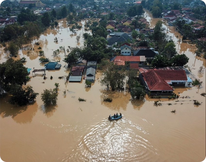
Why unified connectivity matters: Disasters fragment communication networks and scatter response assets. AlphaSight creates a single operational view from all available sources.
- Emergency response drones
- Mobile devices from field teams
- Satellite feeds and aerial imagery sources
Rapid Area Assessment
Quick Mapping
Generate high-resolution orthomosaic and 3D models for immediate damage assessment and tactical planning.
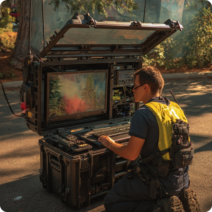
Real-Time Intelligence
Process imagery as it’s captured, identifying structural damage, access routes, and victim locations.
Why Mapping First
Time-critical decisions need accurate data. Ground teams can’t assess the full scope of damage from street level. Aerial mapping provides the complete picture that incident commanders need to allocate resources effectively and identify priority areas. Identify these elements:- Infrastructure damage of roads, bridges, utilities
- Access routes for safe passages for ground teams
- Victim concentrations at around likely congested areas require immediate rescue
- Hazard zones where unstable structures, flooding, chemical spills hold more danger
- Safe zones as staging areas for establishing command posts & rest ares
Response Coordination
When AlphaSight identifies critical situations, rapid response coordination saves livesImmediate Assessment
Live drone feeds provide instant situation assessment before deploying ground teams to dangerous areas
Resource Direction
Guide rescue teams to exact locations using real-time aerial intelligence and safe route identification
Continuous Monitoring
Monitor evolving conditions and emerging hazards throughout response operations
Search and Rescue Operations
Search and Rescue Operations
Thermal imaging locates victims in debris and collapsed structures. Area sweeps identify survivors in large-scale disaster zones, while AlphaSight provides safe route guidance for rescue team navigation.
Damage Assessment
Damage Assessment
AlphaSight enables infrastructure evaluation for emergency services planning, utility damage assessment for restoration prioritization, and environmental hazard identification and monitoring.
Evacuation Support
Evacuation Support
The system supports safe corridor identification for civilian evacuation, transportation route status and accessibility verification, and staging area selection and crowd management support.
Multi-Agency & Remote Response (Coming Soon)
AlphaSight is developing features for even greater flexibility in complex scenarios:- Guest Device allow other devices outside your organization to temporarily connect such as from different agencies for a unified, shared operational view—ideal for joint operations between police, medical, fire and rescue teams.
-
Offline/Remote Mode allows AlphaSight to work even with no connectivity. On-edge processing grants mapping and analysis capabilities for the fastest results. Data auto-syncs when back online, useful for debrief.
Why This Approach Works
Traditional disaster response relies on fragmented communication and delayed assessment reports. AlphaSight transforms response effectiveness by providing:- Rapid situational awareness enabling faster, more informed decisions
- Force multiplication extending limited responder reach across wide areas
- Safety enhancement reducing responder exposure to dangerous conditions
- Coordination improvement enabling effective multi-agency operations through shared intelligence
Next Steps
Ready to enhance disaster response capabilities? Begin with scenario-based training that incorporates AlphaSight into existing emergency protocols. Test the system’s integration with current communication networks and coordinate with aviation authorities for emergency response procedures.Remember: effective disaster response isn’t about perfect technology—it’s about rapidly getting actionable intelligence to the people who need it most, when they need it most.