> ## Documentation Index
> Fetch the complete documentation index at: https://docs.alphasight.app/llms.txt
> Use this file to discover all available pages before exploring further.
# Platform
> Keep up with product releases
## Improvements to LiveOps
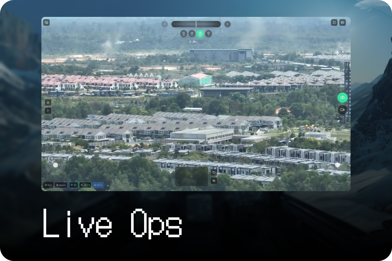 Improvements to the live operations module for an immersive flight experience
* Users can navigate with **on-screen joysticks**
* Pan, tilt, zoom functions via **virtual trackpads**
## Customisable widgets
Improvements to the live operations module for an immersive flight experience
* Users can navigate with **on-screen joysticks**
* Pan, tilt, zoom functions via **virtual trackpads**
## Customisable widgets
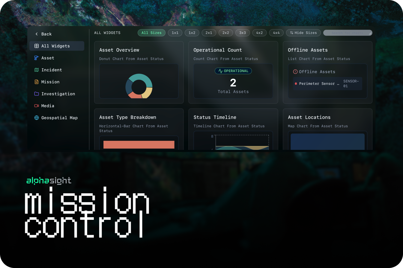 Users can now create, arrange, and customize data widgets on their dashboards for personalized, data-driven decision-making.
* Introduced support for multi-stream content
* Feature matching with charts
**Canary release**
* **Video Detection Pipeline:** Development started on real-time object detection and classification within live video streams
* **Live Command Foundational Capabilities:** Operators to take manual control or override automated drone actions during a live mission via virtual controllers
**Enhancements**
* **UI Component Library Update:** Refreshed UI elements to support the new widget system and improve overall visual consistency
## Custom tags
Users can now create, arrange, and customize data widgets on their dashboards for personalized, data-driven decision-making.
* Introduced support for multi-stream content
* Feature matching with charts
**Canary release**
* **Video Detection Pipeline:** Development started on real-time object detection and classification within live video streams
* **Live Command Foundational Capabilities:** Operators to take manual control or override automated drone actions during a live mission via virtual controllers
**Enhancements**
* **UI Component Library Update:** Refreshed UI elements to support the new widget system and improve overall visual consistency
## Custom tags
 Users can now create and manage custom classification labels and distribute them across different Bases to standardize data tagging within teams. This is foundational to steering VLMs (Vision Language Models)
* **Creation of colllections:** A group of tags that can be associated with areas of interest
* **Tags on Images:** Make edits to images for model training scale up
* **Filter Large Scale Images:** Simplify the list of items on the GIS layer
**Enhancements:**
* **iPad and Mobile Web Responsiveness:** The platform interface is now fully optimized for use on iPads and other mobile web browsers, ensuring a consistent user experience on the go.
* **Base Filtering for Labels:** Added the ability to filter and search for custom labels specific to the Base you are currently working in.
* **Improved Touchscreen Interactions:** Refined drag-and-drop and map navigation controls for better performance on touch-based devices.
## Scene Reconstruction
Users can now create and manage custom classification labels and distribute them across different Bases to standardize data tagging within teams. This is foundational to steering VLMs (Vision Language Models)
* **Creation of colllections:** A group of tags that can be associated with areas of interest
* **Tags on Images:** Make edits to images for model training scale up
* **Filter Large Scale Images:** Simplify the list of items on the GIS layer
**Enhancements:**
* **iPad and Mobile Web Responsiveness:** The platform interface is now fully optimized for use on iPads and other mobile web browsers, ensuring a consistent user experience on the go.
* **Base Filtering for Labels:** Added the ability to filter and search for custom labels specific to the Base you are currently working in.
* **Improved Touchscreen Interactions:** Refined drag-and-drop and map navigation controls for better performance on touch-based devices.
## Scene Reconstruction
 ### 2D Orthophoto
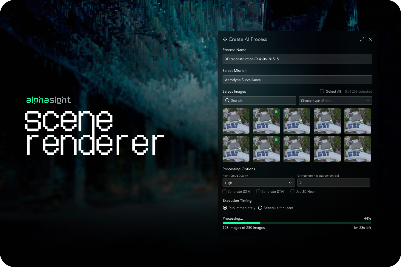
Users can now process drone imagery to generate high-resolution 2D orthomosaic maps directly within the platform.
* Supports up to 300 images per session
* Automated tiling service for web-based rendering directly on the map layer
### 3D Point Clouds
* Capabilities to render detailed 3D point clouds from uploaded image sets for advanced analysis and visualization
**Enhancements**
* **Processing job queue & notifications:** User-facing queue to track the status of reconstruction jobs and receive notifications upon completion
## Feature flagging
* Introduced a modular system to enable or disable features based on user subscription plans, roles, or for canary releases with pilot users
* Administrative UI for managing feature access
**Enhancements**
* Improvements to **live telemetry data sync** for multiple simultaneous operations
* Added functionality to access and remotely debug DJI drone systems through the platform, speeding up troubleshooting
## Multi-Drone Operations Command & Control
### 2D Orthophoto
Users can now process drone imagery to generate high-resolution 2D orthomosaic maps directly within the platform.
* Supports up to 300 images per session
* Automated tiling service for web-based rendering directly on the map layer
### 3D Point Clouds
* Capabilities to render detailed 3D point clouds from uploaded image sets for advanced analysis and visualization
**Enhancements**
* **Processing job queue & notifications:** User-facing queue to track the status of reconstruction jobs and receive notifications upon completion
## Feature flagging
* Introduced a modular system to enable or disable features based on user subscription plans, roles, or for canary releases with pilot users
* Administrative UI for managing feature access
**Enhancements**
* Improvements to **live telemetry data sync** for multiple simultaneous operations
* Added functionality to access and remotely debug DJI drone systems through the platform, speeding up troubleshooting
## Multi-Drone Operations Command & Control
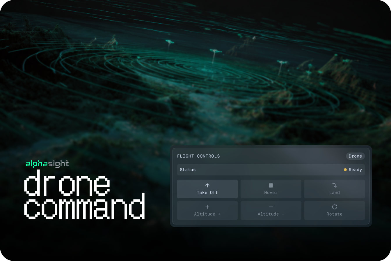 The system now supports simultaneous monitoring and basic control of multiple drone systems, including DJI Dock and M300 RTK models
* Video streams
* Map-based pins for live drone locations
* Remote control of automated dock systems, including mission initiation and monitoring.
**Enhancements**
* **KML Data Imports:** Functionality to designate project data as independent data layers on the map
* **Optimised web stream protocol:** Significantly reduced latency on live video feeds for improved real-time command and control during critical operations
* **Hardware Support Matrix:** Expanded tested and validated support for the M300 RTK with H20T payload, ensuring reliable data ingress
## Geofencing
The system now supports simultaneous monitoring and basic control of multiple drone systems, including DJI Dock and M300 RTK models
* Video streams
* Map-based pins for live drone locations
* Remote control of automated dock systems, including mission initiation and monitoring.
**Enhancements**
* **KML Data Imports:** Functionality to designate project data as independent data layers on the map
* **Optimised web stream protocol:** Significantly reduced latency on live video feeds for improved real-time command and control during critical operations
* **Hardware Support Matrix:** Expanded tested and validated support for the M300 RTK with H20T payload, ensuring reliable data ingress
## Geofencing
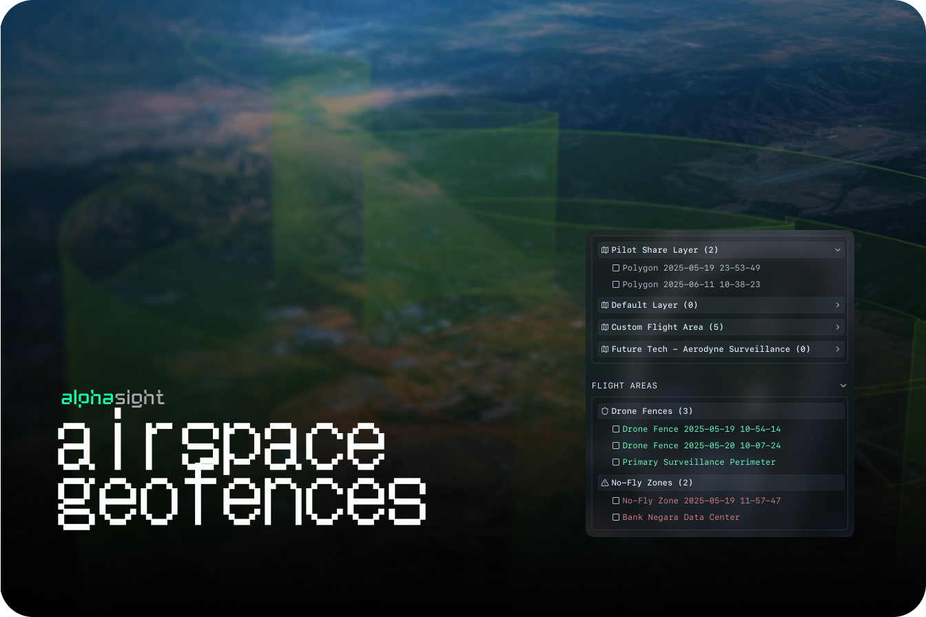 Users can now draw and manage geofences to define operational areas and visualize restricted airspaces on the map.
* **3rd party APIs for airspace data layers:** Integrated third-party data sources to provide up-to-date information on controlled and restricted airspace
* User-defined `restricted` and `fly-zones` map based polygons
**Enhancements**
* **Map rendering performance:** Optimized map tile loading when multiple complex polygon layers (geofences) are active
## Team Management
Users can now draw and manage geofences to define operational areas and visualize restricted airspaces on the map.
* **3rd party APIs for airspace data layers:** Integrated third-party data sources to provide up-to-date information on controlled and restricted airspace
* User-defined `restricted` and `fly-zones` map based polygons
**Enhancements**
* **Map rendering performance:** Optimized map tile loading when multiple complex polygon layers (geofences) are active
## Team Management
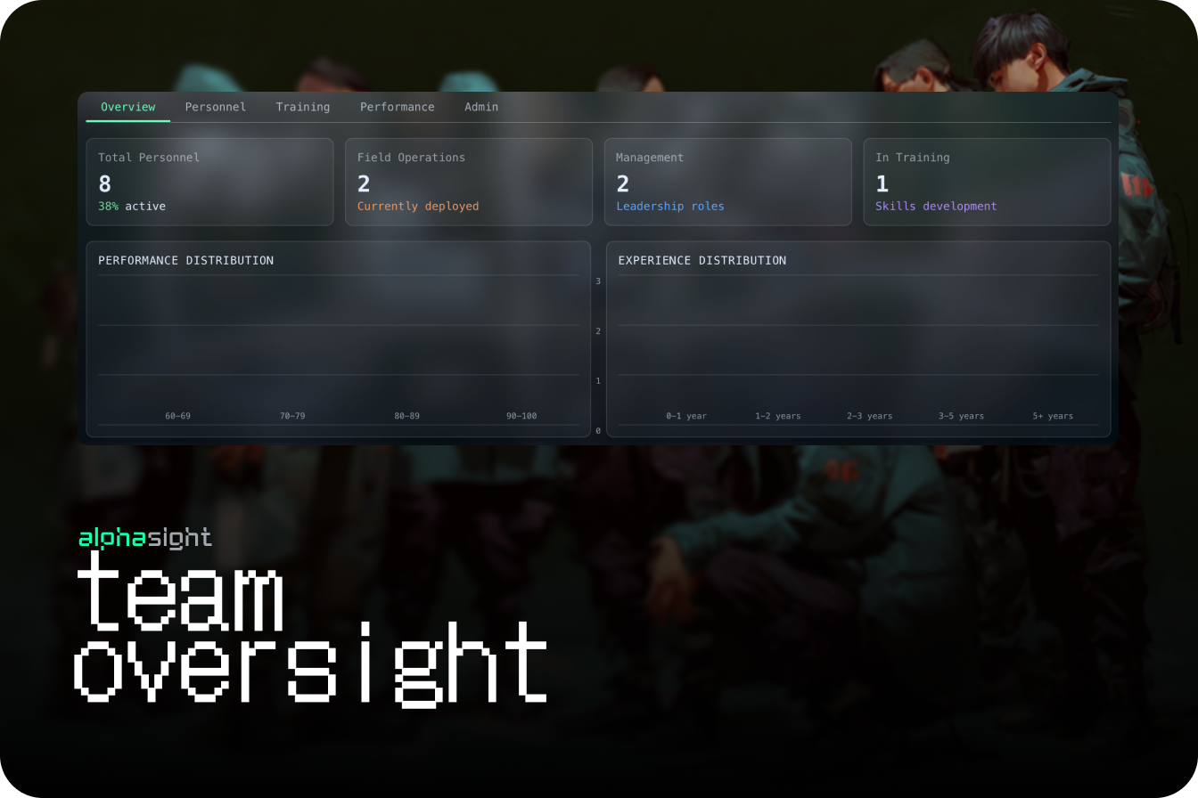 Administrators can now designate user roles, assign operational skills, and log flight hours to track team readiness and training needs.
* Role assignments
* Training hours
## Asset & Fleet Management
Administrators can now designate user roles, assign operational skills, and log flight hours to track team readiness and training needs.
* Role assignments
* Training hours
## Asset & Fleet Management
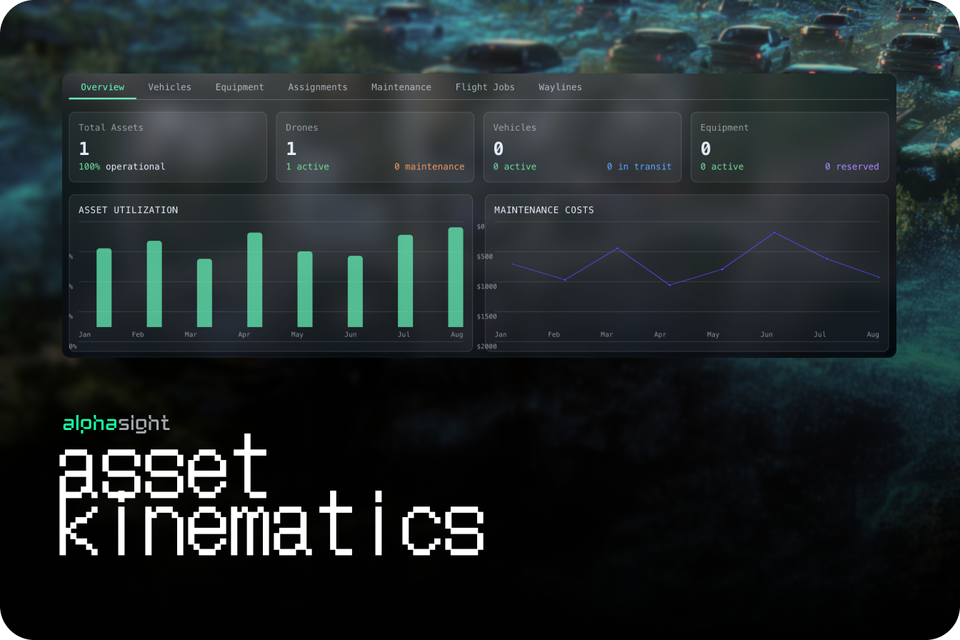 Introduced a system for importing and managing assets, including drone models, serial numbers, and vehicles, laying the groundwork for fleet management
*
**Enhancements**
* Image viewer panels are no longer fixed and can be moved, resized, or stacked, allowing for more flexible data comparison
* User profiles now include fields for logging certifications and total flight hours
## Object Detections
Implemented a foundational AI model for generic object classification on all incoming image data, automating the initial tagging process.
* **Semantic Search Capability:** Users can now use natural language to search for data. For example, a search for "vehicle" will intelligently return results for cars, boats, and trucks
* **Contextual AI-Based Filtering:** Search filters are now enhanced to include AI-detected classifications, allowing users to rapidly sift through massive datasets.
**Enhancements**
* **General UX Refinements:** Introduced more interactive visual elements, improved button states, and refined layout flows for a more intuitive user experience
## Sensor-aware Projections
* **Interactive Geospatial Image Projections:** Images are now projected onto the map view, allowing users to click a location to see the corresponding image and its metadata
* **Manual Object Tagging:** Users can now manually draw bounding boxes on images and apply tags to classify objects, events, or points of interest
* **Basic Search & Filter by Tag:** Implemented a search functionality allowing users to filter the dataset based on their manually created tags and classifications
**Enhancements**
* **Image Metadata Display:** The image viewer now clearly displays all key EXIF data, including GPS coordinates, timestamp, and camera settings
## Introduction to Bases
* **Multi-Tenant Workspaces (Bases):** Introduced the core concept of 'Bases' to segment data, projects, and users, enabling secure, multi-tenant use of the platform
* **New:** **Temporal Timeline View:** Datasets are now automatically organized and visualized on a timeline, providing a clear view of data distribution over time
**Enhancements**
* **Data Clustering Algorithm:** Improved the logic for how datasets are clustered on the map and timeline for more intuitive grouping
* **Base Creation & Management UI:** Built the initial interface for creating, naming, and switching between different Bases
## Core GIS Engine
* **Drag-and-Drop Data Import:** The foundational feature allowing users to easily drag and drop image and data files directly into the platform for ingestion
* **Initial Data Processing Core:** Established the backend service for handling initial data uploads, extracting basic metadata, and storing files
* **Geospatial Data Visualization:** Datasets with location data are now automatically clustered and displayed as points on a world map
**Enhancements**
* **File Type Support:** Initial support for common image formats (JPG, PNG) and associated metadata files
Introduced a system for importing and managing assets, including drone models, serial numbers, and vehicles, laying the groundwork for fleet management
*
**Enhancements**
* Image viewer panels are no longer fixed and can be moved, resized, or stacked, allowing for more flexible data comparison
* User profiles now include fields for logging certifications and total flight hours
## Object Detections
Implemented a foundational AI model for generic object classification on all incoming image data, automating the initial tagging process.
* **Semantic Search Capability:** Users can now use natural language to search for data. For example, a search for "vehicle" will intelligently return results for cars, boats, and trucks
* **Contextual AI-Based Filtering:** Search filters are now enhanced to include AI-detected classifications, allowing users to rapidly sift through massive datasets.
**Enhancements**
* **General UX Refinements:** Introduced more interactive visual elements, improved button states, and refined layout flows for a more intuitive user experience
## Sensor-aware Projections
* **Interactive Geospatial Image Projections:** Images are now projected onto the map view, allowing users to click a location to see the corresponding image and its metadata
* **Manual Object Tagging:** Users can now manually draw bounding boxes on images and apply tags to classify objects, events, or points of interest
* **Basic Search & Filter by Tag:** Implemented a search functionality allowing users to filter the dataset based on their manually created tags and classifications
**Enhancements**
* **Image Metadata Display:** The image viewer now clearly displays all key EXIF data, including GPS coordinates, timestamp, and camera settings
## Introduction to Bases
* **Multi-Tenant Workspaces (Bases):** Introduced the core concept of 'Bases' to segment data, projects, and users, enabling secure, multi-tenant use of the platform
* **New:** **Temporal Timeline View:** Datasets are now automatically organized and visualized on a timeline, providing a clear view of data distribution over time
**Enhancements**
* **Data Clustering Algorithm:** Improved the logic for how datasets are clustered on the map and timeline for more intuitive grouping
* **Base Creation & Management UI:** Built the initial interface for creating, naming, and switching between different Bases
## Core GIS Engine
* **Drag-and-Drop Data Import:** The foundational feature allowing users to easily drag and drop image and data files directly into the platform for ingestion
* **Initial Data Processing Core:** Established the backend service for handling initial data uploads, extracting basic metadata, and storing files
* **Geospatial Data Visualization:** Datasets with location data are now automatically clustered and displayed as points on a world map
**Enhancements**
* **File Type Support:** Initial support for common image formats (JPG, PNG) and associated metadata files